Two Weeks, One Loop: The Complete Cyclades Catamaran Circuit for 2027
The complete two-week Cyclades catamaran loop from Athens, with layover days built in to absorb the meltemi.
Read more
The single most useful skill on a Greek summer charter is reading a greece sailing wind forecast well enough to make a confident go or no-go call each morning. Not memorising what the meltemi is, but knowing which model to trust, how to spot the gusts the headline number hides, and how to turn three forecast sources into one clear plan for the day.
This is a tools-and-skills walkthrough, not another meltemi overview. We will compare the Greek national service against the global models, explain why a forecast of 18 knots can deliver 30 in the wrong spot, and finish with a simple daily routine that has kept plenty of crews out of trouble in the Cyclades.
Three families of forecast cover Greek waters, and good skippers cross-read all three rather than trusting one. The Greek national pages from HCMR’s Poseidon system are built specifically for the Aegean, with high-resolution wind and wave output tuned to the local coastline. They tend to capture the meltemi’s funnel effects better than a coarse global model, which makes them the first thing many crews open over morning coffee.
Then there is Windy, which is really a viewer for several underlying models. The two that matter are ECMWF, the European model, and GFS, the American one. ECMWF is generally the steadier performer for the Mediterranean at the two to four day range, while GFS updates more often and can be twitchier. When ECMWF and GFS agree, you can plan with real confidence. When they disagree by two Beaufort, treat the day as uncertain and keep your options open.
Global models run on a grid, and even a fine grid smooths out the sharp terrain of the Aegean islands. The real wind on the water is shaped by capes, channels and the lee of high islands in ways the headline figure cannot show. That is why a forecast that looks like a comfortable Force 5 can hand you something closer to a Force 7 in a specific gap, and a flat calm two miles further on. Reading the chart means looking past the number to the shape of the land.
The most important habit is separating the sustained wind from the gusts. Sustained wind is the average you will sail in; gusts are the brief peaks that overpower the boat and the crew. On Windy you can toggle a dedicated gust layer, and the gap between the two tells you the day’s real character. A forecast of 20 knots sustained with gusts to 25 is a fine, lively reach. The same 20 knots sustained gusting to 38 is a different animal, and on a catamaran that difference decides whether you reef early or stay tucked up.
Most crews find the gust figure is the one that actually sizes the sail plan. A cat sails flat and fast and hides the load until a gust slams in, so reading the peaks rather than the average keeps you ahead of the boat instead of reacting to it. When in doubt, build your plan around the gusts and you will rarely be caught out.
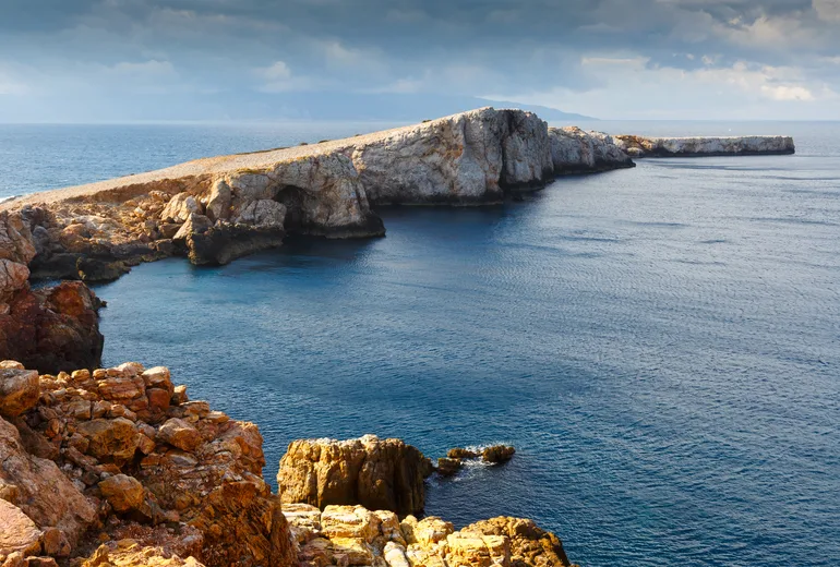
Two local effects matter more than any other in the islands. The first is cape acceleration: as wind bends around a headland it speeds up, often adding ten knots or more right off the point, so the strip of water beside a cape like the southern tip of Andros or the gaps around Kea can be markedly windier than the open passage. Plan to be reefed before you reach it, not while you are in it.
The second is lee gusts off high islands. The lee of a tall island looks like shelter, and the water there is often flat, but the wind tumbling over the ridge arrives as violent, shifting blasts known as katabatic gusts. Crews relax in the smooth water, then get knocked by a 35-knot hit from an odd angle. Treat the lee of any high island as a gust trap and keep a hand near the mainsheet.
Turn all this into a habit. The routine below takes about ten minutes over breakfast and replaces guesswork with a clear decision, which is exactly the kind of flexible thinking our guide to letting the weather shape your Greek itinerary argues for.
The meltemi typically builds through late morning, peaks in the afternoon, and often eases somewhat overnight, though it can blow hard around the clock in a strong spell. The practical upshot is that an early start frequently buys you the calmest water of the day. Crews who leave at first light routinely arrive at the next anchorage before the wind has filled in, which beats wrestling the boat across a building Force 6 after lunch. If you are sketching a route to apply all this to, our 7-day Cyclades sailing itinerary lays out a sensible chain of hops you can flex around the daily forecast.
Wind is only half the picture. The Aegean fetch builds short, steep seas quickly, and a 25-knot day with a long fetch behind it produces a confused chop that punishes a beam reach. Check the wave layer for height and, more importantly, period: a 1.5 m sea at a short period is wetter and more tiring than a longer 2 m swell. A catamaran handles head seas with less drama than a monohull but slaps in steep beam chop, so plan to take the worst of it on the bow or the quarter where you can. For region-specific patterns, our notes on sailing weather in the Cyclades go deeper on what to expect month by month.
Get the forecast reading right and the meltemi stops being a threat and becomes a tool. You learn to use the wind on the days it suits you and to wait it out gracefully on the days it does not, which is the whole art of an Aegean charter.
There is no single best source; the reliable approach is to cross-read three. Start with the Greek Poseidon Aegean forecast for local detail, then compare the ECMWF and GFS layers on Windy. When all three broadly agree you can plan with confidence, and when they diverge you treat the day as uncertain and keep an easy alternative ready.
Sustained wind is the average you will actually sail in, while gusts are the brief peaks that load up the boat. Always check the gust figure, because a day showing 20 knots sustained can gust to 35 in the wrong spot. On a catamaran the gusts size your sail plan, so reef to the peaks rather than the average.
Two local effects do it. Wind accelerates as it bends around a cape, often adding ten knots or more off the point, and the lee of a high island delivers violent katabatic gusts even when the water looks flat. Global models smooth out this terrain, so read the shape of the land alongside the headline number.
It usually builds through late morning, peaks in the afternoon and often eases overnight, though a strong spell can blow hard around the clock. An early departure typically buys you the calmest water, so many crews aim to be at the next anchorage before the wind fills in after lunch.
It depends on the crew, but a common personal ceiling for a relaxed family day is around 25 knots sustained, with experienced crews going higher on a downwind leg. Set your limit before you leave the dock, judge it against the gusts rather than the average, and choose a shorter lee-side hop if the numbers climb past it.
Want to match these skills to a real route? Explore our Greek catamaran charter destinations and plan a week that works with the wind, not against it.